Biogeographic variation in decomposition of a foundation species
Project Title: Biogeographic variation in decomposition of a foundation species
Duration: January 2024 – June 2024
Funding Source: Duke University
Lead Investigator / onsite-contact: David DeLaMater / Megan Tyrrell
Affiliation: Duke University / Waquoit Bay NERR
Email: daviddelamater@duke.edu / megan.tyrrell@mass.gov
Project Description: The purpose of this project is to investigate the relative role of plant traits versus environment in determining the rate of decomposition in smooth cordgrass (Spartina alterniflora).
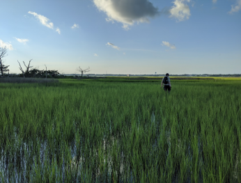
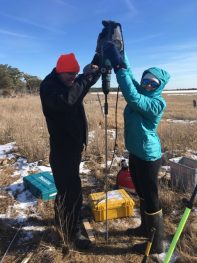
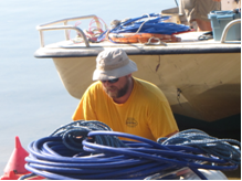
Hoop Pole Marsh, Atlantic Beach NC; one of our four decomposition sites
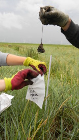
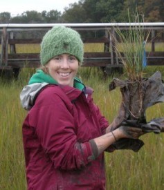
Salt marshes are an important coastal ecosystem from which we derive many useful ecosystem services. Chief among those services is carbon storage. Smooth cordgrass (Spartina alterniflora) plays an outsized role in salt marsh ecosystems, not unlike the role played by the grasses of the prairies in the Midwest. The rate at which smooth cordgrass decomposes is a main driver of the rate at which salt marshes store carbon; the more decomposition, the less carbon storage. In our previous investigations, we found that smooth cordgrass growing at southern latitudes has much tougher tissue than the same species growing at northern latitudes. It’s well known that tougher plant tissue takes longer to decompose. At the same time, we also know that warmer environments are more conducive to faster decomposition rates than are cold environments. This leads us to ask the question: Which is more important to smooth cordgrass decomposition, their toughness or their environment? This is an increasingly relevant question as climate change will result in future northern marshes having similar temperature regimes as present southern marshes. Stated simply, will tougher grass be harder to decompose no matter the latitude, or will environment trump all other effects?
To investigate this, we have collected smooth cordgrass from multiple latitudes (which have different levels of toughness), and used it to create “litter bags”, which are a standardized way to measure decomposition rates. We will deploy these litter bags at multiple latitudes (different environments) and measure the rate of decomposition over roughly 5 months. We hypothesize that grass placed in southern latitudes will decompose more quickly than grass placed in northern latitudes, and also that within each latitude, tougher grass will decompose more slowly than less tough grass.
Efficacy of established and emerging tidal marsh restoration methods
Project Title: Efficacy of established and emerging tidal marsh restoration methods
Lead Investigator: Brian Yellen, UMass Amherst, byellen@umass.edu
Onsite Contact: Sintra Reves-Sohn, UMass Amherst, srevessohn@umass.edu
Project Description: Salt marshes are extremely beneficial to surrounding communities because they provide recreational spaces, control floods, and improve water quality. Salt marshes also effectively store carbon and are home to resident species, such as the endangered saltmarsh sparrow and commercially and culturally important fish stocks. Vegetation is key to salt marsh survival; when the marsh is flooded at high tide, salt marsh vegetation traps sand and mud, which makes it possible for the salt marsh to build upward. This is especially important for salt marsh survival when sea level is rising quickly. If the marsh can’t build elevation, it will be outrun by rising sea levels. In addition to the threat of sea level rise, the Dog’s Head Marsh at Waquoit Bay National Estuarine Research Reserve is vulnerable due to an undersized culvert that was removed in 2008. Pre-removal, the culvert prevented tides from traveling far upstream, causing the once salty ecosystem to “freshen,” which in turn causes the land to subside (become low in elevation). When the culvert was removed in 2008, saltwater flooded this upstream area, which caused the freshwater vegetation to die, and creating a muddy expanse. The aim of this project is to characterize how sediment is moving through Sage Lot Pond and into Dog’s Head Marsh at WBNERR and understand how this relates to how Dog’s Head Marsh’s vegetation has adapted post-culvert removal. With this information, we can better predict how Dog’s Head Marsh will continue to adapt to rising sea level and we can make recommendations to how to best preserve the salt marsh.
Hyperlocal water level monitoring
Project Title: Hyperlocal water level monitoring
Duration: 2011-present
Funding Source: NERRS Science Collaborative and other sources
Principal Investigator(s), institutional affiliation(s), and contact info:
Lead Investigator / onsite-contact: Vitalii Sheremet, Megan Tyrrell
Affiliation: Okeanolog, WBNERR
Email: vsheremet@whoi.edu, megan.tyrrell@mass.gov
 Project Description: We have been employing a simple and inexpensive system of water level monitoring utilizing a custom built FloatArm water level based on Onset Computer’s HOBO Pendant G accelerometer logger. With funding from the NERRS Science Collaborative, we installed about hundred instruments at seven National Estuarine Research Reserves from Maine to Florida. The monitoring results allow us to characterize different types of flooding and draining at various features in the tidal marshes, which permits analysis of the spatial patterns and timing of inundation in the marsh. Pool drainage rates are often not consistent with those of the larger system and cannot be perfectly predicted by pool bottom elevation. Use of open ocean tide gauges to evaluate inundation periods for marshes could lead to misaligned restoration planning that doesn’t accurately reflect local conditions. The float arm system is efficient for understanding local hydrological conditions at the scale where restoration implementation is conducted. Examples of pertinent applications include runnels, ditch remediation, sediment augmentation and removal or remediation of tidal restrictions.
Impacts of tidal hydrology on maritime forest and coastal marsh dieback
Project Title: Impacts of tidal hydrology on maritime forest and coastal marsh dieback
Duration: July 2023 – Dec 2023 (continuation of July 2020-present project)
Funding Source(s): NSF, Geological Society of America Student Grant
Principal Investigator: Elizabeth Watson, Stony Brook University (Elizabeth.b.watson@gmail.com )
Onsite Contact: Andrew Payne, Drexel University and the Academy of Natural Sciences (ap3752@drexel.edu)
Project Description: This project will analyze groundwater patterns, salinity, and plant stress using mapping of near-infrared spectral indices, and plant photosynthesis measures to address knowledge gaps in our understanding of the impacts of sea level rise to maritime forests and salt marsh. We are focusing on understanding the proximate causes of marsh forest dieback by building robust and complementary geospatial datasets focusing on key hydrologic factors and plant stress indicators. This project also involves study sites in New Jersey and New York.
Seasonal changes in Salicornia depressa metal accumulation and rhizosphere composition
Seasonal changes in Salicornia depressa metal accumulation and rhizosphere composition
Duration: June 2023—September 2023
Funding Source: Startup grant from the University of Massachusetts Boston to B. Moyers
Principal Investigators, institutional affiliation: Brook Moyers / Alice Palmer
Affiliation: University of Massachusetts Boston, Biology
Email: brook.moyers@umb.edu, alice.palmer001@umb.edu
Project Description: Salicornia species, known in New England as pickleweeds, form mutually beneficial relationships with soil microbes living on the plant’s roots (the rhizosphere), which can help improve plant growth under stressful conditions. They are also capable of accumulating metals from the soil at high concentrations. We are studying how the bacteria present in the Salicornia depressa rhizosphere differ from those in the soil surrounding the plant. We also are interested in how changes in the plants’ biology over the course of the growing season and seasonal changes in salt marsh soil chemistry affect both the rhizosphere’s composition and its ability to accumulate metal from soil. To investigate this, we are collecting samples of S. depressa, its rhizosphere, and the surrounding soil in June, before the plants begin to flower, in August, as they are flowering, and in September, as they begin to senesce. We will sequence bacteria in the rhizosphere and surrounding soil for each timepoint. We will also test the amount of metal in the soil, in S. depressa’s roots, and in S. depressa’s shoots at each timepoint to determine how much metal the plant is accumulating and where it is being stored. These results will help us understand how S. depressa copes with metal stress and its potential in removing metals from polluted marshes.
Restoring hydrology using runnels and salt marsh N biogeochemistry
Project Title: Restoring hydrology using runnels and salt marsh N biogeochemistry
Duration: Aug 2022-Jul 2024
Funding Source(s): Margaret A. Davidson Graduate Fellowship, NOAA
Lead Investigator / onsite-contact: Linda Deegan, Jen Bowen, Meagan Tyrrell
Affiliation: Woodwell Climate Research Center; Northeastern University
Email: hsullivan@woodwellclimate.org
 Project Description: Salt marshes are highly dynamic and variable systems providing many ecosystem services such as shoreline stabilization and nutrient filtration. However, because of their location within the tidal frame and proximity to human activity, they are vulnerable to a combination of anthropogenic and climatic disruptions. The objectives of this project are to understand the effects of altered hydrology via sea-level rise on the vulnerability of salt marsh productivity and N removal, and if restoration can enhance the resiliency to future changes. We will implement a relatively new restoration strategy called runnels, which are shallow channels designed to help drain standing water off the marsh surface and encourage vegetation. This project will examine unintended consequences of such restoration strategies on N cycling.
Impacts of tidal hydrology on maritime forest and coastal marsh dieback
Project Title: Impacts of tidal hydrology on maritime forest and coastal marsh dieback
Duration: July 2022 – Dec 2022 (continuation of July 2020-2021 project)
Funding Source(s): NSF, Geological Society of America Student Grant
Principal Investigator: Elizabeth Watson (Elizabeth.b.watson@gmail.com)
Onsite Contact: Andrew Payne (ap3752@drexel.edu)
Affiliation: Drexel University and the Academy of Natural Sciences
Project Description: This project will analyze groundwater patterns, salinity, and plant stress using mapping of near-infrared spectral indices, and plant photosynthesis measures to address knowledge gaps in our understanding of the impacts of sea level rise to maritime forests and salt marsh. We are focusing on understanding the proximate causes of marsh forest dieback by building robust and complementary geospatial datasets focusing on key hydrologic factors and plant stress indicators. This project also involves study sites in New Jersey and New York.
Pilot Drone Mapping of Marsh Biomass and Species for estimating Vegetation Drag
Title: Pilot Drone Mapping of Marsh Biomass and Species for estimating Vegetation Drag
Lead Investigator / onsite-contact: Heidi Nepf
Affiliation: Civil and Environmental Engineering, Massachusetts Institute of Technology
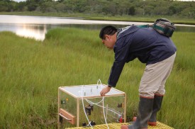
The flow resistance provided by coastal marshes mitigates flooding by slowing storm surge and damping waves. It also controls the flooding and draining of the marsh platform during the tidal cycle. The flow resistance (drag) provided by a marsh varies with seasonal growth, marsh erosion, and marsh area gained by restoration. It would be useful to have a method that directly measures marsh drag, which would improve the prediction of flooding and inform coastal planning, risk assessment, and restoration design. The Nepf lab has developed models that estimate drag on individual plants as a function of plant shape and rigidity, velocity and flow depth. In this project, we will develop a method to measure the number of plants per bed area and the species using drones to map biomass, plant height, and identifying geometric features. Combining measured plant density (plant per bed area) with predicted drag per plant will yield a measurement of flow resistance per marsh area. MASS DOT will fly the pilot drone mission to measure the spatial distribution of biomass, species, and plant height.
USGS-Woods Hole Spectroradiometer Testing and UAV flights
Project Title: USGS-Woods Hole Spectroradiometer Testing and UAV flights
Duration: (9/22/2021 to 10/29/2021):
Funding Source(s): USGS
Lead Investigator: Jennifer Cramer, USGS Woods Hole Coastal and Marine Science Center
Phone:716-708-2103
Email:jcramer@usgs.gov
Project Description: We plan to conduct a study comparing two spectroradiometer systems: an ASD FieldSpec, the industry standard, against the OceanInsight HDX Mini Spectrometer, a cost-saving alternative. Spectroradiometers collect surface light reflectance values over a range of wavelengths for whatever material they are aimed at. Reflectance data of certain wavelengths beyond the visible range, such as infra-red can tell a lot about the health of vegetation. Reflectance over a range of wavelengths is called spectra. Surface types reflect unique spectra that can be used in statistical models to generate maps of land cover type from multi- and hyper-spectral aerial imagery. This is especially useful for scientists at our center that monitor these rapidly changing coastal environments. Our access to spectroradiometers is limited, which makes timely and accurate spectral analyses difficult. The motivation for this comparative study is to determine the accuracy and functionality of an affordable alternative so that we can improve our spectral data collection capabilities and products. We plan to collect side-by-side reflectance datasets that include vegetation, sand, parking areas, and other surface types using these two spectroradiometers. Additionally, we plan to collect aerial imagery with Unoccupied Aircraft Systems (UAS) concurrently as ancillary data.
Transfer of a low-cost tidal wetland water level monitoring system: hyperlocal calculations of inundation and tidal datums for understanding change and restoration planning
Title: Transfer of a low-cost tidal wetland water level monitoring system: hyperlocal calculations of inundation and tidal datums for understanding change and restoration planning
Affiliation: Okeanolog/WBNERR
Funding Source: NERRS Science Collaborative Science Transfer gran
Contact/Email: Megan Tyrrell, Research Coordinator, WBNERR (megan.tyrrell@mass.gov)
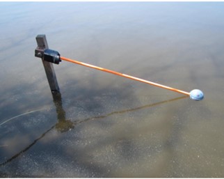
Abstract: Waquoit Bay Reserve ongoing water level monitoring program focusing on discrete salt marsh microhabitats and employing a simple and inexpensive system of water level monitoring developed by PI Vitalii Sheremet. The ‘Arm-and-Float’ water level instrument uses a HOBO Pendant G accelerometer. These easy to deploy loggers have been used in several types of salt marsh habitats (e.g., pools, creeks and upstream of a tidal restriction) at WBNERR and other NERRs.
The principle of operation is based on converting the raw signal of the arm tilt into the elevation of the float relative to a fixed pivot by multiplication by the arm length. In this way, accuracy of 5-10 mm is achieved, which is adequate for calculating tidal datums for each feature where the logger is deployed. In May 2021, 20 arm-and-float loggers were deployed across Sage Lot Pond for water level monitoring in conjunction with seven other Reserves spanning a range of climactic and tidal regimes which also received arm-and-float loggers as part of the science transfer grant. At the conclusion of this project, locally relevant tidal datums will be calculated, and enhanced understanding of the differences in inundation regime for 20 salt marsh features including creeks, pools, nascent pools, surrounding potential tidal restrictions will be available.
Evaluating the Impact of Hydrologic Alterations on Salt Marsh Sustainability in a Changing Climate
Project Title: Evaluating the Impact of Hydrologic Alterations on Salt Marsh Sustainability in a Changing Climate
Project Partners: Cape Cod Mosquito Control Project, Louisiana State University, National Park Service, United States Fish and Wildlife Service, Rachel Carson National Wildlife Refuge, United States Geologic Survey, Waquoit Bay National Estuarine Research Reserve, Woods Hole Oceanographic Institution
Coastal managers are faced with the challenge of managing marsh hydrology in a way that meets human health needs, optimizes ecosystem services, and supports sustainability. In New England this includes accounting for the effects of ditches that were dug decades ago in 90% of the region’s salt marshes.
Ditches increase marsh drainage and reduce the spatial extent of shallow pools that may represent physical loss of buried soil carbon. However, efficient drainage may reduce the long-term sustainability of marshes by altering below ground biogeochemical and physical processes in a way that results in subsidence and lowered marsh elevation. Managers, restoration practitioners, and scientists at the Waquoit Bay National Estuarine Research Reserve, Woods Hole Oceanographic Institution, U.S. Geological Survey, U.S. Fish and Wildlife Service, National Park Service, and the Cape Cod Mosquito Control Project have expressed a need to understand the tradeoffs of hydrologic management strategies (i.e., ditch remediation, density, maintenance) and identify actions that will achieve user-specified outcomes— such as drainage, maintaining elevation, and carbon burial.
Products:
FACT SHEET: Project Overview
WHOI Website: Marsh Sustainability & Hydrology
Marshes, Mosquitos & Sea Level Rise-Oceanus Magazine Video Link
Marsh Sustainability and Hydrology (MSH) Project Webinar
October 2020
The MSH project is a collaborative research effort involving partners from the University of Georgia, Woods Hole Oceanographic Institution, Louisiana State University, United States Geological Survey, Cape Cod Mosquito Control, US Fish and Wildlife Service, National Park Service and the Waquoit Bay National Estuarine Research Reserve.
Coastal resource managers are tasked with making decisions that simultaneously address the welfare of local communities and the sustainability of salt marshes and the valuable ecosystem services they support. In New England, anthropogenic ditches were dug to reduce shallow ponds on the marsh platform where mosquitos breed, although this may have led to unintended consequences such as lower elevations and increased susceptibility to sea-level rise. In order to evaluate the net impacts of ditching to carbon storage and elevation resilience, we collected cores from the ditched and unditched sections of Great Barnstable Marsh (MA, USA) and measured and compared accretion rates, soil properties, soil organic carbon and ages to determine impact of ditching on marsh sustainability to sea level rise. A geomorphic model calibrated with field data was used to develop a decision support tool to help managers assess impact of different management strategies on salt marsh sustainability and ecosystem service delivery.
To view the workshop presentations please go to: Marsh Sustainability and Hydrology Project Webinar Presentation Videos
MSH Team Members:
Amanda Spivak, Principal Investigator, University of Georgia
Sheron Luk, PhD Student, Woods Hole Oceanographic Institution
Meagan Eagle, United States Geological Survey
Gabrielle Sakolsky, Director, Cape Cod Mosquito Control
Susan Adamovich, US Fish and Wildlife Service
Giulio Mariotti, Louisiana State University
Megan Tyrrell, Research Coordinator, Waquoit Bay National Estuarine Research Reserve
Tonna-Marie Surgeon Rogers, Director, Waquoit Bay National Estuarine Research Reserve
Genetic Variation and Adaptation in the Salt Marsh Plant Salicornia depressa
Project Title: Genetic Variation and Adaptation in the Salt Marsh Plant Salicornia depressa
Date: 2019
Principal Investigator: Brook Moyers,
Affiliations: University of Massachusetts
Summary: Salicornia are small annual saltwater marsh plants that grow throughout coastal New England and globally. They are edible and have potential uses as agricultural commodities or as phytoremediators of sites contaminated with heavy metals. We are characterizing the genetic diversity and adaptive potential of the most common New England native species, S. depressa, for which little data currently exists. To do so we sequence DNA from individual plants in populations across coastal New England along with the microbial rhizosphere (soil microorganisms closely associated with plant roots). We also analyze the soil in which plants are growing to understand its chemical composition. This research could assist in planning and management of genetic resources and amelioration of industrial/urban contaminants for coastal wetlands, and more broadly will provide insight into the diversity and capacity of this potentially valuable species.
Tackling microplastic pollution in Waquoit Bay
Project Title: Tackling microplastic pollution in Waquoit Bay
Date: 2019 Principal Investigator(s): Javier Lloret , Rut Pedrosa-Pamies
Affiliation: Marine Biological Laboratory
Link to Cape Cod Times article: https://www.capecodtimes.com/news/20190810/tackling-microplastic-pollution-in-waquoit-bay
Additional Resources: Salt marsh sediments act as sinks for microplastics and reveal effects of current and historical land use changes. Microplastic particles are widespread in marine sediments and the abundance of the different types of particles vary widely. In this paper we demonstrate (read the full article).
Spatial variability of carbon export from tidal marsh drainage
Project Title: Spatial variability of carbon export from tidal marsh drainage
Date: 11/2018-8/2019
Principal Investigator(s): Joseph Tamborski
Affiliations: Woods Hole Oceanographic Institution
Summary: Salt marshes provide significant environmental and economic value by shielding coastal communities against storm-surges and sequestering CO2 from the atmosphere, acting as a natural buffer to climate change. Carbon is both buried by marsh plants and exported to the coastal ocean from tidal drainage. However, the spatial variability of carbon export from tidal drainage across a salt marsh platform is largely unknown. Our two main objectives are to [1] characterize salt marsh hydrology under present and future climate scenarios; and [2] to determine the spatial and temporal variability of carbon export from tidal marsh drainage. Sediment cores, marsh pore waters and vertical temperature profiles will be sampled across marsh platforms, toward the tidal creek, to help reveal spatial patterns in seasonal exchange fluxes. Hydrogeological models will be used to assess salt marsh resiliency to changing climate scenarios. These tasks aim to reveal how salt marshes impact carbon cycling and biogeochemistry of the Northwest Atlantic and identify the vulnerability of these critical wetlands to changing terrestrial and marine conditions.
Phragmites porewater geochemistry
Project Title: Phragmites porewater geochemistry
Date: 6/2019-8/2019
Principal Investigator(s): Meagan Gonneea
Affiliations: U.S. Geological Survey: Woods Hole Coastal and Marine Science Center
Summary: Methane is an important greenhouse gas produced during methanogenesis, a metabolic pathway for decomposing organic matter in saturated soils. Conditions that favor this organic matter decomposition pathway include low salinity and high water levels, conditions that also promote the growth of phragmites. However, methane production in phragmites patches in coastal wetlands is highly variable, indicating that methane production and subsequent flux to the atmosphere are dependent on the geochemical environment. This project will compare methane cycling in phragmites patches at Sage Lot Pond to the Herring River, an impounded salt marsh in Wellfleet, MA, to better understand what environmental drivers impact methane cycling in phragmites coastal wetlands. This project is being conducted by a PEP student with USGS staff.
USGS Drone Flights at Sage Lot Pond
Project Title: USGS Drone Flights at Sage Lot Pond
Date: 7/2017-7/2018
Principal Investigator(s): Kevin Kroeger, Sandy Brosnahan, Meagan Gonneea
Affiliations: USGS
Summary: The U.S. Geological Survey in Woods Hole is developing drone technology applications for salt marsh research. Salt marshes are important coastal ecosystems in terms of habitat for birds and fish, recreational opportunities, coastal protection and as a natural carbon sink. Current scientific challenges involve mapping these environments, including their elevation, morphology, and plant composition, at sufficient spatial resolution and coverage. Current field methods are labor intensive, allowing for small spatial coverage, while satellite based products with broad spatial coverage typically have a spatial resolution that is too coarse to resolve important changes that may occur over several meters in fringing wetlands. Our project goal is to evaluate the use of drone based 3-D digital elevation mapping capabilities across coastal wetland platforms, including creeks and ponds, as well as utilize the spectral, or different types of light, signatures of coastal vegetation as in indicator of species composition and plant stress. The salt marsh observatory at Sage Lot Pond run by WBNERR offers unique opportunities to ground-truth aerial mapping technology. We seek to coordinate with WBNERR’s annual vegetation surveys to optimize application of the drone technology.
Intertidal salt marshes as an important source of inorganic carbon to the coastal ocean
Project Title: Intertidal salt marshes as an important source of inorganic carbon to the coastal ocean. Limnology and Oceanography, 61(5), 1916-1931.
Date: 2016
Principal Investigators: Wang, Z. A., Kroeger, K. D., Ganju, N. K., Gonneea, M. E., & Chu, S. N.
Abstract: Dynamic tidal export of dissolved inorganic carbon (DIC) to the coastal ocean from highly productive intertidal marshes and its effects on seawater carbonate chemistry are thoroughly evaluated. The study uses a comprehensive approach by combining tidal water sampling of CO2 parameters across seasons, continuous in situ measurements of biogeochemically‐relevant parameters and water fluxes, with high‐resolution modeling in an intertidal salt marsh of the U.S. northeast region. Salt marshes can acidify and alkalize tidal water by injecting CO2 (DIC) and total alkalinity (TA). Read Full text: http://onlinelibrary.wiley.com/doi/10.1002/lno.10347/full
Genotype environment associations support a mosaic hybrid zone between two tidal marsh birds
Project Title: Genotype environment associations support a mosaic hybrid zone between two tidal marsh birds.
Date: 2016
Principal Investigators: Walsh, J., Rowe, R. J., Olsen, B. J., Shriver, W. G., & Kovach, A. I. (2016).
Summary: Ecology and Evolution, 6(1), 279-294. http://onlinelibrary.wiley.com/doi/10.1002/ece3.1864/full
Precision Monitoring of Water Level in a Salt Marsh with Low Cost Tilt Loggers
Title: Precision Monitoring of Water Level in a Salt Marsh with Low Cost Tilt Loggers.
Date: 4/2016
Authors: Sheremet, V. A., & Mora, J. W. (2016).
Affiliation: NOAA Northeast Fisheries Science Center, Woods Hole MA, United States vsheremet@whoi.edu, Waquoit Bay National Estuarine Research Reserve, Falmouth MA, United States jordan.mora@state.ma.us
Publication: In EGU General Assembly Conference Abstracts (Vol. 18, p. 8794). http://adsabs.harvard.edu/abs/2016EGUGA..18.8794S
Abstract: Several salt pannes and pools in the Sage Lot tidal marsh of Waquoit Bay system, MA were instrumented with newly developed Arm-and-Float water level gauges (utilizing accelerometer tilt logger) permitting to record water level fluctuations with accuracy of 1 mm and submillimeter resolution. The methodology of the instrument calibration, deployment, and elevation control are described. The instrument performance was evaluated. Several month long deployments allowed us to analyze the marsh flooding and draining processes, study differences among the salt pannes. The open channel flow flooding-draining mechanism and slower seepage were distinguished. From the drain curve the seepage rate can be quantified. The seepage rate remains approximately constant for all flooding draining episodes, but varies from panne to panne depending on bottom type and location. Seasonal differences due to the growth of vegetation are also recorded. The analysis of rain events allows us to estimate the catch area of subbasins in the marsh. The implication for marsh ecology and marsh accretion are discussed. The gradual sea level rise coupled with monthly tidal datum variability and storm surges result in migration and development of a salt marsh. The newly developed low cost instrumentation allows us to record and analyze these changes and may provide guidance for the ecological management.
Assessing tidal marsh resilience to sea-level rise at broad geographic scales with multi-metric indices
Project Title: Assessing tidal marsh resilience to sea-level rise at broad geographic scales with multi-metric indices
Date: 2016
Principal Investigator(s): Raposa, K. B., et al. (2016).
Affiliation: Kenneth B. Raposa (a), Kerstin Wasson (b), Erik Smith (c), Jeffrey A. Crooks (d), Patricia Delgado (e), Sarah H. Fernald (f), Matthew C. Fernerg (g), Alicia Helms (h), Lyndie A. Hice (i), Jordan W. Mora (j), Brandon Puckett (k), Denise Sanger (l), Suzanne Shull (m), Lindsay Spurrier (n), Rachel Stevens (o), Scott Lerberg (p)
a. Narragansett Bay National Estuarine Research Reserve, 55 South Reserve Dr., Prudence Island, RI 02872
b. Elkhorn Slough National Estuarine Research Reserve, 1700 Elkhorn Road, Watsonville, CA 95076
c. North Inlet-Winyah Bay National Estuarine Research Reserve, PO Box 1630, Georgetown, SC 29442
d. Tijuana River National Estuarine Research Reserve, 301 Caspian Way, Imperial Beach, CA 91932
e. Jug Bay Wetlands Sanctuary, 1361 Wrighton Road, Lothian, MD 20711
f. Hudson River National Estuarine Research Reserve, 256 Norrie Point Way, P.O. Box 315, Staatsburg, NY 12580
g. San Francisco Bay National Estuarine Research Reserve, 3152 Paradise Drive, Tiburon, CA 94920
h. South Slough National Estuarine Research Reserve, P.O. Box 5417, Charleston, OR 97420
i. Delaware National Estuarine Research Reserve, 818 Kitts Hummock Road, Dover, DE 19901
j. Waquoit Bay National Estuarine Research Reserve, 131 Waquoit Hwy, Woods Hole, MA 02536
k. North Carolina National Estuarine Research Reserve, 101 Pivers Island Rd., Beaufort, NC 28516
l. ACE Basin National Estuarine Research Reserve, 217 Fort Johnson Road, Charleston, SC 29412
m. Padilla Bay National Estuarine Research Reserve, 10441 Bayview-Edison Road, Mount Vernon, WA 98273
n. Grand Bay National Estuarine Research Reserve, Mississippi Department of Marine Resources, 6005 Bayou Heron Road, Moss Point, MS 39562
o. Great Bay National Estuarine Research Reserve, 89 Depot Rd, Greenland, NH 03840
p. Chesapeake Bay National Estuarine Research Reserve of Virginia at the Virginia Institute of Marine Sciences, 1375 Greate Road., Gloucester Point, VA 23062
Summary: Biological Conservation, 204, 263-275.
Tidal marshes and the ecosystem services they provide may be at risk from sea-level rise (SLR). Tidal marsh resilience to SLR can vary due to differences in local rates of SLR, geomorphology, sediment availability and other factors. Understanding differences in resilience is critical to inform coastal management and policy, but comparing resilience across marshes is hindered by a lack of simple, effective analysis tools. Read full text… http://www.sciencedirect.com/science/article/pii/S0006320716305742
Carbon dioxide fluxes reflect plant zonation and below ground biomass in a coastal marsh
Project Title: Carbon dioxide fluxes reflect plant zonation and below ground biomass in a coastal marsh
Date: 2016
Principal Investigators: Moseman‐Valtierra, S., Abdul‐Aziz, O. I., Tang, J., Ishtiaq, K. S., Morkeski, K., Mora, J., & Carey, J.
Summary: Coastal wetlands are major global carbon sinks; however, they are heterogeneous and dynamic ecosystems. To characterize spatial and temporal variability in a New England salt marsh, greenhouse gas (GHG) fluxes were compared among major plant‐defined zones during growing seasons. Carbon dioxide (CO2) and methane (CH4) fluxes were compared in two mensurative experiments during summer months (2012–2014) that included low marsh (Spartina alterniflora), high marsh (Distichlis spicata and Juncus gerardii‐dominated), invasive Phragmites australis zones, and unvegetated ponds. Read Full text…Ecosphere, 7(11). http://onlinelibrary.wiley.com/doi/10.1002/ecs2.1560/full
Direct and indirect trophic effects of predator depletion on basal trophic levels
Project Title: Direct and indirect trophic effects of predator depletion on basal trophic levels
Date: 2016
Principal Investigator(s): Chen, H., Hagerty, S., Crotty, S.M., & Bertness, M.D.
Abstract: Human population growth and development have heavily degraded coastal ecosystems with cascading impacts across multiple trophic levels. Understanding both the direct and indirect trophic effects of human activities is important for coastal conservation. In New England, recreational overfishing has triggered a regional trophic cascade. Predator depletion releases the herbivorous purple marsh crab from consumer control and leads to overgrazing of marsh cordgrass and salt marsh die‐off. Read full text…Ecology, 97(2), 338-346. http://onlinelibrary.wiley.com/doi/10.1890/15-0900.1/full
Evaluation of laser-based spectrometers for greenhouse gas flux measurements in coastal marshes
Project Title: Evaluation of laser-based spectrometers for greenhouse gas flux measurements in coastal marshes
Date: 2016
Principal Investigator(s): Brannon, E. Q., Moseman-Valtierra, S. M., Rella, C.W., Martin, R.M., Chen, X. and Tang, J.
Abstract: Precise and rapid analyses of greenhouse gases (GHGs) will advance understanding of the net climatic forcing of coastal marsh ecosystems. We examined the ability of a cavity ring down spectroscopy (CRDS) analyzer (Model G2508, Picarro) to measure carbon dioxide (CO2), methane (CH4), and nitrous oxide (N2O) fluxes in real‐time from coastal marshes through comparisons with a Shimadzu GC‐2014 (GC) in a marsh mesocosm experiment and with a similar laser‐based N2O analyzer (Model N2O/CO, Los Gatos Research) in both mesocosm and field experiments. Read full text… Limnol. Oceanogr. Methods, 14: 466–476. doi:10.1002/lom3.10105. http://onlinelibrary.wiley.com/doi/10.1002/lom3.10105/full
Spartina alterniflora Biomass Allocation and Temperature: Implications for Salt Marsh Persistence with Sea-Level Rise
Project Title: Spartina alterniflora Biomass Allocation and Temperature: Implications for Salt Marsh Persistence with Sea-Level Rise
Date: 2017
Principal Investigator(s): Crosby, S.C., Angermeyer, A., Adler, J.M., Bertness, M. D., Deegan, L.A., Sibinga, N., & Leslie, H.M.
Abstract: To predict the impacts of climate change, a better understanding is needed of the foundation species that build and maintain biogenic ecosystems. Spartina alterniflora Loisel (smooth cordgrass) is the dominant salt marsh-building plant along the US Atlantic coast. Read full text…Estuaries and Coasts, 40(1), 213-223. http://link.springer.com/article/10.1007/s12237-016-0142-9
Indirect human impacts turn off reciprocal feedbacks and decrease ecosystem resilience
Project Title: Indirect human impacts turn off reciprocal feedbacks and decrease ecosystem resilience
Date: 2015
Principal Investigator(s): Bertness, M.D., Brisson, C.P., & Crotty, S.M.
Summary: Creek bank salt marsh die-off is a conservation problem in New England, driven by predator depletion, which releases herbivores from consumer control. Many marshes, however, have begun to recover from die-off. We examined the hypothesis that the loss of the foundation species Spartina alterniflora has decreased facilitator populations, weakening reciprocal positive plant/animal feedbacks, resilience, and slowing recovery. Read full text…Oecologia, 178(1), 231-237. https://link.springer.com/article/10.1007/s00442-014-3166-5
Thin-layer sediment placement: evaluating an adaptation strategy to enhance coastal marsh resilience across the NERRS
Project Title: Thin-layer sediment placement: evaluating an adaptation strategy to enhance coastal marsh resilience across the NERRS
Lead Investigator: Dr. Kenny Raposa, Research Coordinator, Narragansett Bay National Estuarine Reserve
WBNERR Project Contact: Dr. Megan Tyrrell
8 Reserves Included in Project: Great Bay NH, Waquoit Bay MA, Narragansett Bay RI, Chesapeake Bay MD, Chesapeake Bay VA, North Carolina, Grand Bay MS, Elkhorn Slough CA
Summary: Tidal marshes provide key ecosystem services, but are threatened by sea level rise. Narragansett Bay and Elkhorn Slough NERRs recently led a project to assess marsh resilience to sea level rise across 16 NERR sites, resulting in a scientific publication, user-friendly summary, and DIY tool. Currently, eight NERR sites across the East, Gulf and West coasts are actively testing strategies to examine the effectiveness of thin-layer sediment placement as a climate adaptation strategy.
Novel aspects of our project include the broad geographic scale, the examination of effectiveness at different marsh elevations, standardized monitoring, and the incorporation of biochar as a soil amendment to enhance carbon sequestration. Beneficial use of dredged sediment to enhance coastal resilience is a concept that resonates in many coastal states, and we have interviewed end-users from eight states interested in funding, permitting, implementation or monitoring of thin-layer sediment projects.
Quantifying the biogenic silica content of primary producers in Waquoit Bay
Lead Investigator: Robinson W. “Wally” Fulweiler, Sarah Foster, PhD student, Mollie Yacano, undergraduate researcher
Affiliation: Boston University, Earth and Environment Department
Funding Source(s): Undergraduate Research Opportunities Program (UROP), Boston University
Investigating Salt Marshes as a source of Alkalinity and Low pH, High CO2 water to the Ocean
Project Title: Investigating Salt Marshes as a source of Alkalinity and Low pH, High CO2 water to the Ocean
Principal Investigators: Kevin Kroeger, Meagan Gonneea, U.S. Geological Survey: Woods Hole Coastal and Marine Science Center, Aleck Wang, WHOI
Funding Source(s): USGS, NSF
Examining decapod community composition and species interactions in salt marshes across New England
2016
Harriet Booth, Patrick Barrett, Meredith Burke, Dr. David Kimbro
Northeastern University
Funding Source(s): Northeastern University
Tea bag decomposition experiment
Principal Investigators: Dr. Faming Wang, Dr. Jianwu (Jim) Tang, Marine Biological Laboratory
 We use commercially available tea bags as standardized test kits to gather data on salt marsh decomposition rates. This is a cost-effective, well-standardised method. By using two tea types with contrasting decomposability, we can construct a decomposition curve using a single measurement in time. We will compare the decomposition rate within the high marsh and low marsh, and also in the warmed chamber versus ambient reference. Our data was also included in a worldwide cooperation network to investigate the decomposition rate in different ecosystems using the tea bag method.
To read more about the tea bag experiment and its relationship to blue carbon research, please visit:
http://bluecarbonlab.org/ and also http://www.teatime4science.org/about/the-project/
Relationship of phenotypic variation and genetic admixture in the Saltmarsh-Nelson’s sparrow hybrid zone
Project Title: Relationship of phenotypic variation and genetic admixture in the Saltmarsh-Nelson’s sparrow hybrid zone
Date: 2015
Principal Investigator(s): Walsh, Jennifer, et al.
Abstract: Hybridization is influential in shaping species’ dynamics and has many evolutionary and conservation implications. Identification of hybrid individuals typically relies on morphological data, but the assumption that hybrids express intermediate traits is not always valid, because of complex patterns of introgression and selection. Read full text…The Auk 132.3: 704-716. https://academic.oup.com/auk/article/132/3/704/5149087
The Great Sippewissett salt marsh plots—some history, highlights, and contrails from a long-term study
Project Title: The Great Sippewissett salt marsh plots—some history, highlights, and contrails from a long-term study
Date: 2015
Principal Investigator(s): Valiela, I.
Summary: During the 2013 meeting of the Coastal and Estuarine Research Federation, Iris Anderson, acting on behalf of the CERF Board, invited me to write an Odum Essay, describing the long stretch of work done in the Great Sippewissett Marsh in Cape Cod, MA, reviewing findings, and recalling how the sequence of results moved the efforts forward across over 40-plus years. Read full text…Estuaries and Coasts, 38(4), 1099-1120. https://link.springer.com/article/10.1007/s12237-015-9976-9
Experimental mapping of coastal habitats using small airborne remote-sensing technology
Project Title: Experimental mapping of coastal habitats using small airborne remote-sensing technology
Principal Investigators: Hanu Singh, WHOI, David Fisichella, WHOI, Jim Rassman, WBNERR
Summary: WHOI scientists are working with Reserve staff, using a small hobby-plane equipped with GPS and camera to take high-resolution photos of the salt marsh and shore at South Cape Beach. These photos are useful for public presentations, but more importantly can map change over time, damage from storms, results of controlled burns, animal populations (such as seals), etc. 
Greenhouse Gas Sensing in Coastal and Salt Marsh Environments
Project Title: Greenhouse Gas Sensing in Coastal and Salt Marsh Environments
Date: 2012
Principal Investigators Anna Michel, Princeton University
Funding: WHOI and submitted grants (NSF, MIT Seagrant)
The Effects of Nitrogen-loading on Arthropod Diversity and Food-Web Dynamics in Salt Marshes
PIs: Gina Wimp, Georgetown University
Dan Lewis, Georgetown University
Shannon Murphy, Denver University
Funding: NSF
Salt Marsh Sediment Sources – the role of Barrier Beach Aeolian Sand Transport and Deposition
Project Title: Salt Marsh Sediment Sources – the role of Barrier Beach Aeolian Sand Transport and Deposition
Principal Investigator: Camille David, UMASS-Dartmouth, PhD Candidate
Advisor: Brian Howes, UMASS-Dartmouth
Funding: UMASS-Dartmouth, WBNERR collaborative in-kind
Comparing Methods and the Stability of Deep-Driven Rod Elevation Benchmarks and SETs in a Salt Marsh Environment
 PIs: Philippe Hensel, National Geodetic Survey
Galen Scott, National Geodetic Survey, University of RI
Jim Lynch, US Geological Survey
WBNERR Staff: Jim Rassman, Jordan Mora, Chris Weidman
Description: Sediment Elevation Tables (SETs) and benchmarks are used to measure change in marsh elevation with millimeter scale accuracy to determine sedimentation rates. This information, combined with accurate water level measures, can assess whether salt marshes are keeping up with sea level rise or risk being “drowned.” Traditionally SETs and benchmarks are installed by driving metal rods deep into the earth until they hit resistance. This can be difficult and costly as each 4’ length of rod is expensive. This project is investigating whether it is necessary to drive the rods that deep, or whether they are just as stable at, say, 20’ depth. Rods have been driven to different depths in the South Cape Beach salt marsh and are being “leveled” regularly – measured against a known point – to see if they have shifted. If not, this research could result in new standards for installation of this infrastructure which would save significant time and money. This is one of a growing number of projects in the new “Climate Change Observatory” in this marsh.
Late Holocene Marine Transgression and the Drowning of a Coastal Forest: Lessons from the Past
PI: Chris Maio, UMASS-Boston, PhD Candidate.
Advisor: Allan Gontz, UMASS-Boston
Funding: UMASS-Boston, Geological Society of America Research Award, collaborative in-kind-WBNERR
My research looks at coastal changes that have occurred in response to sea-level rise and storminess during the past 4000 years. I use a variety of methods including sediment core analysis, ground penetrating radar, GIS, and radiocarbon dating. Learning about how the Waquoit estuarine system responded to past sea level-rise and storminess will provide needed context for understanding and anticipating future changes.
An ancient red cedar forest was first revealed after a series of storms in 2010 resulted in significant erosion along South Cape Beach revealing 111 subfossil stumps along the beach and into the water. Thirteen stumps were radiocarbon dated and ranged in age from ~413-1200 years old. We assume this age represents the time at which the ancient trees were drowned by marine waters. Shoreline change analysis showed that between 1846 and 2008, the shoreline fronting the paleoforest retreated landward by 70 m at a long-term rate of 0.43 m/yr. 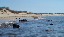
Sediment cores were analyzed to determine storm and sea level history. Radiocarbon dates of bivalve microfossils indicate that Waquoit Bay was first inundated by marine waters approximately 3600 years ago. The ongoing research will help decipher the relationship between sea-level rise, storminess, and the inundation of terrestrial ecosystems and will help to illuminate what caused the drowning of the South Cape Beach paleoforest.
Salt Marsh Productivity and Consumer Control in a Changing Climate
 PI: Sarah Corman, Brown University, PhD Candidate.
Funding: NERRS Graduate Research Fellowship at WBNERR (current)
“The goal of my research at WBNERR is to investigate how Spartina alterniflora, the foundation species of salt marshes, will respond to rising temperatures, and to what extent salt marshes can resist drowning under predicted rates of sea level rise. Aboveground growth, in stems and leaves, and belowground growth, in roots and rhizomes, work in concert to maintain elevation and resist marsh drowning, and yet we don’t understand the patterns and processes driving the relationship of above to belowground growth. I am also exploring how the timing of flowering in Spartina influences elevation change and seed production. Understanding these mechanisms in salt marshes is critical to predicting potential loss of these ecosystems in the future.” http://sarahcorman.wordpress.com/
The Impact of Nitrogen-loading on Salt Marsh Greenhouse Gas Fluxes
 PIs: Serena Moseman-Valtierra, University of Rhode Island, Jianwu Tang, MBL Ecosystems Center, Kevin Kroeger, USGS-Woods Hole Science Center,
Funding: MIT Seagrant
The general goal for the project is to measure potential greenhouse gas (GHG) emissions and net CO2 uptake in coastal wetlands under a range of realistic nitrogen (N) loads and inundation (sea) levels. By meeting this goal, we aim to improve the information with which managers and policy makers can maintain and maximize ecosystem productivity, reduce harmful feedbacks of climate, and assess the potential for these ecosystems to enter C markets.
We will examine how GHG emissions from salt marshes vary along an existing gradient of anthropogenic N loading in Waquoit Bay, MA (WB-NERR). Further, we will test for relationships between N loads to the marshes and plant productivity. To investigate the influence of anticipated future increases in sea level, we will use existing gradients in marsh soil elevation (and therefore a gradient in soil water saturation and in frequency and duration of soil inundation) as a space-for-time substitution simulating future inundation of soils.
Carbon Management in Coastal Wetlands: Quantifying Carbon Storage and Greenhouse Gas Emissions by Tidal Wetlands to Support Development of a Greenhouse Gas Protocol and Economic Assessment
Project Title: Carbon Management in Coastal Wetlands: Quantifying Carbon Storage and Greenhouse Gas Emissions by Tidal Wetlands to Support Development of a Greenhouse Gas Protocol and Economic Assessment
Project Lead: Alison Leschen, Waquoit Bay Reserve Manager
Collaborative Lead: Tonna-Marie Rogers, Waquoit Bay Coastal Training Program Coordinator
Principal Investigator(s): Jianwu Tang, MBL Ecosystems Center, Kevin Kroeger, USGS-Woods Hole Science Center, Neil K. Ganju, USGS-Woods Hole Science Center, Serena Moseman-Valtierra, University of RI, Omar Abdul-Aziz, Florida International Univ., Stephen Emmett-Mattox, Restore America’s Estuaries, Igino Emmer, Silvestrum, Stephen Crooks, Consultant to RAE, Pat Megonigal, Smithsonian ERC, Thomas Walker, Manomet CCS, Chris Weidman, Waquoit Bay Reserve Research Coordinator,
Funding: NERRS Science Collaborative
Summary: Increasing atmospheric concentrations of three major greenhouse gases (GHG) are the main drivers of climate change. Efforts to ameliorate rising levels of GHG include the protection and restoration of ecosystems that constitute major carbon (C) sinks and minor sources of CH4 and N2O emissions. Tidal marshes are prime candidates for such efforts as their sediments display high C sequestration. Loss of wetlands through human impacts such as land conversion, sediment supply disruption, nutrient loading, and with sea level rise, reduces future sequestration capacity and places at risk stores of C that built up over past centuries. Improved management of coastal C and nitrogen (N), based upon sound science, is a critical first step towards mitigation of climate change and management of coastal ecosystems. Management must address N loading that has the dual impact of 1) contributing to climate change through production of N2O, and 2) reducing production of root and soil matter by plants which can decrease the C sequestration capacity and resilience of marshes to sea level rise. Recognition of the importance of coastal marine systems in terms of C storage has led to national and international efforts to place monetary value on preserving or restoring the “blue carbon” in those systems, analogous to the value placed on forests. The barrier to incorporation of tidal wetlands into C markets is the absence of agreed upon GHG offset protocols that set guidelines for monitoring and verification requirements for wetlands projects, and a lack of data and knowledge regarding C and GHG fluxes in wetlands to support model development.
The project goals are to provide scientific information that can inform both C and N management as well as wetlands protection and restoration strategies for supporting development of policy frameworks and market-based mechanisms to reduce GHG.
Project website: https://waquoitbayreserve.org/research-monitoring/salt-marsh-carbon-project/